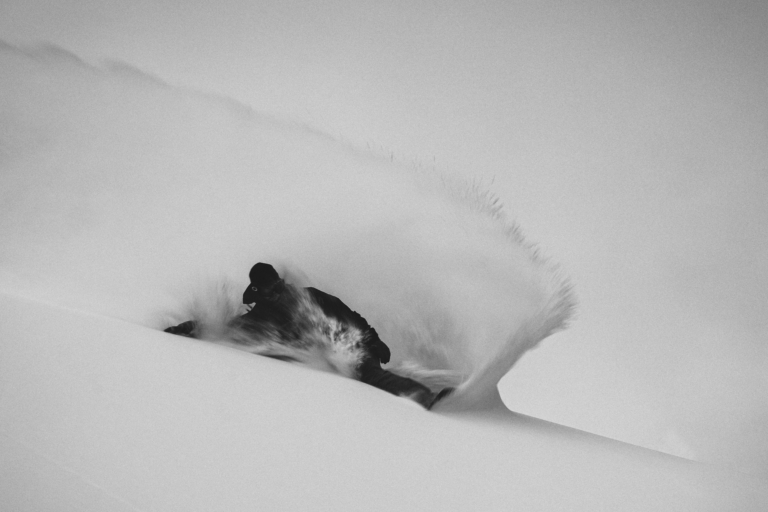
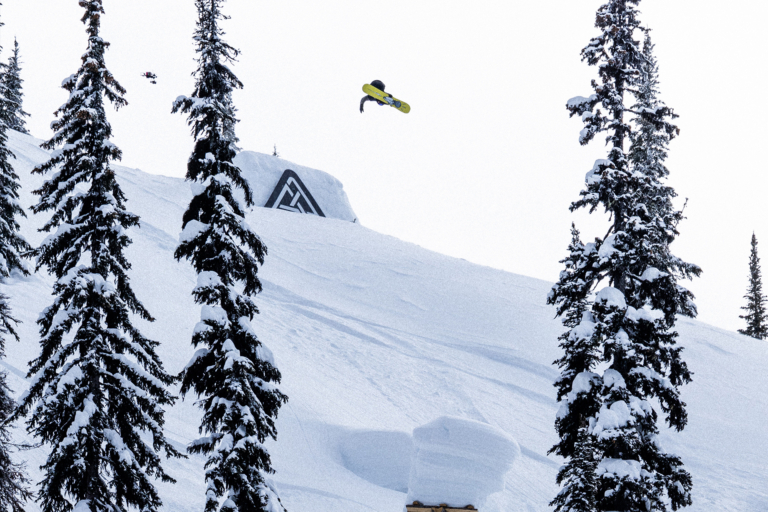
By looking at the latest OpenSnow powder graphic, located below, you’ll notice Mother Nature is blessing North America with a shit ton of snow. This week might be the best week of the winter so far. So get out your pow stick and hurry to the mountain cause you’re not going to want to miss this one!
Read below for more details on where to get the goods this week.
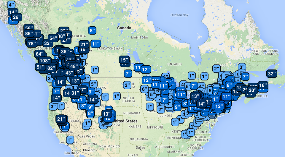
Note: All snow totals listed are taken Wednesday morning and derived from the five day powder forecast on OpenSnow.com. Forecasts are subject to change.
British Columbia
Wow. BC is going to get hammered harder than Cal Naughton Jr. at a Lynyrd Skynyrd concert. Aside from the heli ops, which are forecasting up to 108 inches of snowfall in five days, many BC ski areas will remain in the 40-inch range for that timeframe. Whistler Blackcomb is looking at 41 inches by Sunday, while Whitewater and Red Mountain will be more in the 30 to 36 inch range.
Pacific Northwest
A much needed refresh is about to occur in Washington and Oregon. In the Beaver State, Mt. Bachelor is looking at 14 inches of snow while the Mt. Hood area will be more in the half a foot range.
In the southern part of Washington, Crystal Mountain and White Pass are looking at about 11 inches of snow, while farther north, Stevens Pass is forecasted for nine inches and Mt. Baker 13 inches.
With the fresh pow set to blanket Washington and Oregon, be sure to stop in at evo Seattle or evo Portland to get your setup dialed before heading out into the storm.
The Northeast
The East Coast has been enjoying possibly the best conditions in the United States over the past two weeks, and the snow isn’t about to let up. Beginning Wednesday, snow will move into Maine. Mt. Jefferson is looking at about 13 inches of snow, while Sugarloaf and Saddleback are expecting about eight inches.
In New Hampshire, resorts in the northeastern part of the state like Loon, Cannon, Wildcat and Attitash are in for anywhere from eight to 10 inches of the fresh stuff.
Southern Vermont is looking at some hefty snow totals, as well. Magic Mountain, Bromley, Mount Snow and Stratton will all be in the eight to 10 inch range by Sunday.
New York ski areas can also expect over a foot of snow in the coming days, with Hunter Mountain, Windham Mountain and Kissing Bridge all looking at 14 inches.
Alberta
Alberta will also get a healthy dose of white magic. Marmot Basin, in Jasper National Park, is looking at 21 inches by Sunday, while Lake Louise can expect a solid 17 inches.
Colorado
Coloradans who are sick of that high pressure ridge that’s been hanging around this January should rejoice, as new snow is on the way. On Wednesday morning, many resorts in northern Colorado woke up to heavy snowfall. The white stuff will continue to fly through Sunday, with resorts like Steamboat, Winter Park and Copper all expecting between 11 and 13 inches of snow. Southern and central resorts like Telluride and Aspen will probably stick to the four to six inch range.

Utah
The Beehive State is also poised for snow, with the heavier amounts coming Wednesday and Friday. By Sunday, Alta and Snowbird can expect about nine new inches of snow, while the Park City resorts are looking at more like six inches of the freshies.
The Northern Rockies
Jackson Hole locals woke up to 14 inches of new snow this morning; that ain’t too shabby. As the week rolls on, they can expect another 14 inches, while elsewhere in Wyoming, Grand Targhee is expecting more like 11 inches.
In Idaho, Silver Mountain is forecasted for a solid 13 inches of snow by Sunday, Sun Valley can expect 11 and Schweitzer about eight.
Montana has been having a solid season so far. This week, the state will be gearing up for some more pow days, with Big Sky expecting eight inches and Whitefish looking at seven.
Sierra Nevada
Is this the storm that turns the season around for the Sierras?
The most snow in the state will be in the Lake Tahoe area, with Squaw Valley/Alpine Meadows and Sugar Bowl expecting 21 inches on Saturday night. Can you say, Sunday Funday? In the Eastern Sierras, Mammoth can expect seven inches of snow.
The Midwest
Don’t forget about the Midwest! Bueno Vista, Giants Ridge and Spirit Mountain in Minnesota are all looking at about 11 inches of pow. In Michigan Nub’s Knob and Boyne Mountain are looking at about 11 inches of fresh.