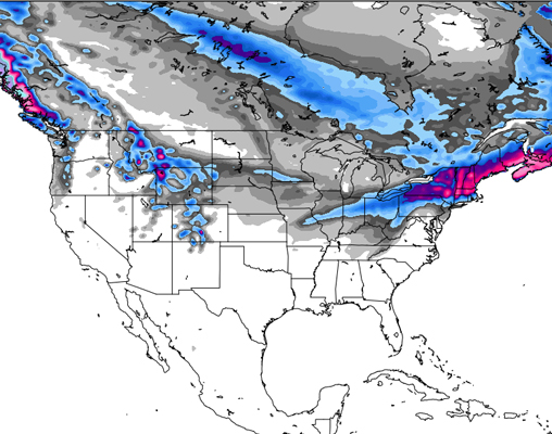
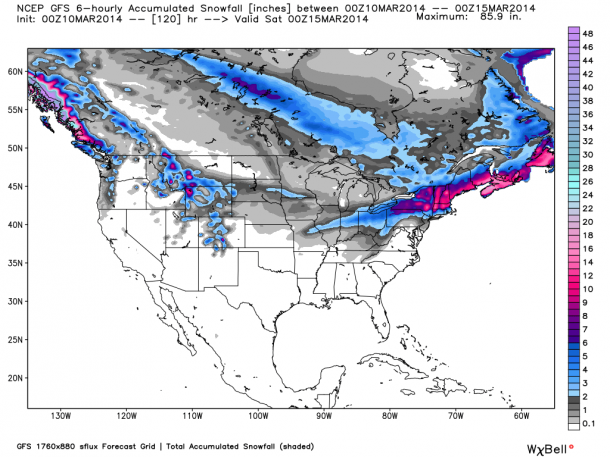
While the PNW, Northern Rockies and Colorado mellow out for a spell, storms are ramping up in the Northeast, with Thursday holding out the best chance for a powder day in New England.
As our friends over at Opensnow.com have so diligently reported, The Northern Rockies will be getting a fresh coat over the weekend, while the Midwest endures some scattered showers before the air warms up and temps rise. On the whole, this week will be pretty quiet across the country, with the next chance for substantial snowfall coming around the middle of next week.
The Pacific Northwest
Things are looking might quiet in Oregon this week, with little to no snow in the forecast until next Wednesday. The only exceptions seem to be Mt. Hood Meadows and Timberline, where 7 and 6 inches, respectively, are predicted to fall on Friday.
Things are looking slightly more promising in Washington, with snow kicking off on Thursday and leaving up to 10 inches at Stevens Pass and Mt. Baker by Saturday, while Summit at Snoqualmie (Alpental) can expect just about 7 inches. Looking ahead, the beginning of next week will be pretty quiet across the state, with snow making its next appearance around Thursday, though North Cascade Heli is projected to see up to 6 inches on Monday, and another 6 on Wednesday while the rest of the state sits stagnant.
The Northern Rockies
Up in Montana, Wednesday and Thursday will remain quiet across the state, with small accumulations— think 1-2 inches— coming through on Friday and Saturday. Forecasts for the end of next week, however, are calling for hefty snowfall Wednesday through Friday, with areas like Lost Trail Powder Mountain and Big Sky getting hit especially hard, up to 12″ expected Friday alone.
Similar to Montana, Wyoming is looking at bluebird skies Wednesday, through Friday, with small storm systems moving through this weekend. Meadowlark Ski Lodge may see up to 7 inches by Monday, with Jackson Hole, Teton Pass and Snow King expected to see just about 5 inches. The same goes for Idaho, as Friday brings in a small dose of new snow, Silver Mountain scoring just about 6 inches while Lookout Pass is expected to see 5 or so.
The Northeast
It looks like a mid-week storm is in the works for New England, with early predictions calling for a foot or more through interior New England for Wednesday into Thursday. Cold air is expected to continue through the end of the week, with another dose of snowfall showing up over the weekend as a system moves through higher-elevation areas.
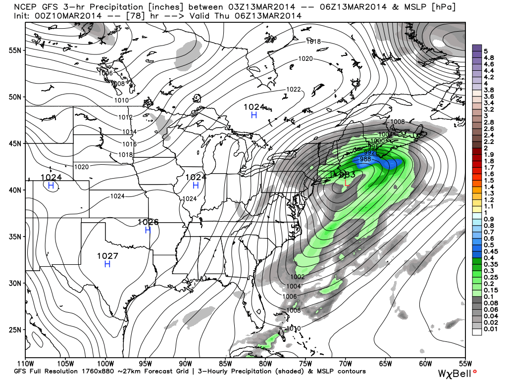
Click here for more on the Northeast
Colorado
After a nice little dose of snow on Tuesday, Colorado is looking at two weak systems to blow through this week, one on Saturday and another next Tuesday. The latter part of this week will be dry and breezy, except for the San Juans where a few snow showers may make an appearance. Looking at the long-range forecast, Colorado Daily Snow’s Joel Gratz predicts a chance for snow every few days, starting Tuesday, March 18.
Utah
It is shaping up to be a mellow week in Utah after the storm that hit Monday night. According to Utah Daily Snow meteorologist Evan Thayer, it is unlikely that the region will see any snowfall for the next week or so, as the latter part of March holds the most promise for new snow.
The Sierras
Sunny, blustery days are in store for the Tahoe region, with the next chance for snow coming next Tuesday and Wednesday. Overall, not too much to be said for The Sierras, though colder air and a higher likelihood of snowfall comes as next week winds down.
For more info, check out The Tahoe Daily Snow
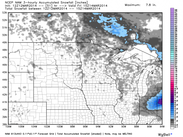
The Midwest
Beginning on Wednesday, the Midwest is expected to experience a series of weak storm systems across northern Minnesota and Wisconsin — an inch or 2 expected to fall Wednesday into Thursday. Further south, over central Wisconsin and southern Minnesota, temps will be warming up over the next few days, boosting the mercury back up to a more average temperature for the region. While the weekend looks sunny, some showers may move across the northern part of the region, though the forecast isn’t showing any substantial accumulations.