Top Elevation: 6288 ft (Mt. Washington) Vertical Drop: 4256 ft total, 600 ft Tuckerman Ravine, 1400 ft Hillman’s Highway Trails: 1 cut trail, Sherburne Ski Trail Terrain: Mostly advanced to expert, some lower angle faces generally occupied by drunk tubers from Boston, Sherburne Trail is intermediate terrain. Lifts: 0Weather Reports: Intellicast National Weather Service Mount Washington Weather Observatory Avalanche Report: Tuckerman Ravine Web Sites: www.tuckerman.org Time for Tuckerman Friends of Tuckerman

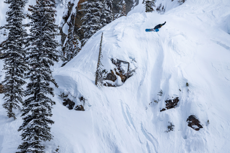
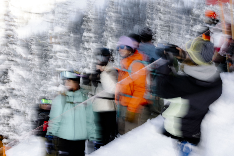
Background: Okay, so its no real secret, Tuckerman Ravine is not a resort; there are no lifts, no fancy lodges, and no parks. However, due to its well-built hiking trails, lean-to lodges, and masses of attention hunger Joeys, it really does not qualify as a true backcountry experience. So it lives, as it has since winter sports took hold in the Northeast, somewhere in the middle. From my first days as a snowboarder, I have been making the yearly pilgrimage. With its wide open steeps and ridiculous snow depths, it stands virtually unchallenged as the proving grounds for anyone in the Northeast looking for big mountain terrain. For quite awhile, it was as close as I came to having a base resort so I figured I would write it up. Access: To access the bowl, you start off at Pinkham Lodge on Rt. 16 in New Hampshire. From there it is a 2-3 hour hike on a virtual highway to the camp area, along this hike you will have the opportunity to laugh at some very under prepared Joeys and some very over prepared French Canucks in matching Descende one pieces. This is followed by another 45 minutes to an hour hike to the base of the bowl. Generally this is where my hands turn into popsicles. At the base, you will find the Lunchrocks to poseur’s right. This is where the drunk folks congregate to heckle the people coming down, its also a nice place to work on that Paris Hilton tan or eat lunch as the name implies.

Terrain: 6. Hillman’s Highway 7. Duchess 8. Left Gully 10. The Chute 14. The Icefall 15. The Lip 16. The Sluice 17. Right Gully I typically scale the bowl just to the right of the lip (15). About three quarters of the way up, a large rock face protrudes. Besides making it a real pain to go straight up, it is generally the source of undermining due to the radiate heat. Now I will have you know this is not the most expedious way to reach the good terrain. Many people hike directly up the chute (10). As I cannot stand hikers appearing out of nowhere when I am descending at speed, I avoid hiking up in these locations even if it costs me a run.

Tuckerman’s is a bit steep, even in comparison to the terrain of the Alps or Rockies. I always forget this and end up with no real good clue of what is coming at me as I descend. Take time at the base and locate a few landmarks to use on your way down. My favorites runs are the Chute (10), just to poseur’s right of the chute (11), and the Sluice (16). Another lesson that I learned the hard way is that the shadows move quickly in the afternoon turning the nice spring corn to boilerplate in minutes.

A few times, I have been lucky enough to get first tracks over the lip on a 60 degree day. Unfortunately this was also the day that I learned the above lesson. I was ripping into the flats when I crossed into the shadows and affectively performed a nose edge catch, catapulting my face into the snow. I spent one winter hiking Mt. Washington a couple times a week with my good friend Price. Early season in the bowl can be ton of fun as all sorts of trannies and drops are about prior to full snowfall. Even if the top is socked in typical Speckled Hen conditions, the Sherburne Trail is a ton of fun. It is long and windy, narrow at times, and banked in places. If you look, there are some hidden gems. I used to just follow Price, trying to match his idiotic lines and his crooked cops off the tiny rises. Beware of the water bars both early and late season, they will chew your knees and calves. Once you make it back to Pinkham, you will no doubt want to find a bar to tell everyone how much ass you kicked. My personal favorites are the Shannon Door, Tuckerman’s, Margarita Grill, Delaney’s, and Hooligans. Weather and Snow: Due to its location at the intersection of three major weather patterns, Mount Washington receives some of the worst recorded weather in the world. Things change extremely quickly, regardless of the season. I have been caught in snowstorms in July and one mean lightning storm in early March. No matter when you go or for how long, it is strongly recommended to pack for all conditions Snow falls on Mount Washington every month of the year. Yearly snowfall on the summit of Mount Washington averages 645 cm. Average annual snowfall at lowland stations in the area is about 287 cm. On average, at least 2.5 cm of snow falls 68 days a year. The snowiest winter on record was 1968-69, when 1438 cm fell on Mount Washington. The pervasive high winds move large quantities of snow off the upper elevations, resulting in incredible wind loading events for the avalanche starting zones along the flanks and ravines of the range. Wind-blown snow is a major contributor to large avalanche cycles in the range. Average snowfall for Mt. Washington is 314.8 in/yr. Snow depths on the floor of Tuckerman Ravine on the lee side of Mount Washington average 12 to 16 m. Dangers: The number of deaths in the Mount Washington vicinity is well documented. As of 2004, 131 people have lost their lives in the region. The dangers for snowboarders are the common ones experienced in any alpine region. Avalanches are prevalent, especially in mid winter when the brutal winds create massive wind loading. The bigger issue, in my opinion, is undermining and the cavernous crevasses that result. It seems like every year they fish another person out from below the ravine. As with any situation, common sense and thinking about what you are doing will generally keep you out of trouble. Be careful and have fun. seth